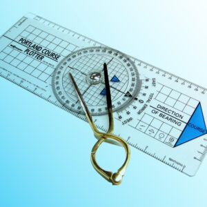
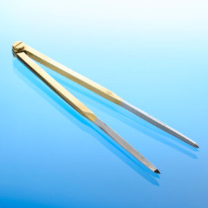
The Portland Course Plotter, often referred to as a nautical protractor, is an essential tool for mariners navigating at sea. It plays a vital role in accurate chart plotting, which is a fundamental aspect of maritime navigation. The plotter is specifically designed to measure angles and courses on nautical charts, enabling mariners to determine their vessel’s heading with precision. By using the Portland Course Plotter, navigators can calculate the direction a ship needs to travel in relation to the Earth’s geographical coordinates.
Features include:
- Printed by hand.
- Moulded base with domed feet for easy of movement across a sea chart.
- Moulded compass disc with raised fins for easy rotation – even with cold hands or gloves.
- Brass pivot is lubricated with silicon grease for smooth operation.
- Every plotter is checked for accuracy during assembly.
One of the key functions of the Portland Course Plotter is to help determine a vessel’s true heading, meaning the direction relative to true north as opposed to magnetic north. This is crucial for maintaining navigational accuracy, especially in regions where magnetic variation may cause compass errors. With the plotter, mariners can correct for these variations and ensure their course is accurately plotted on the chart.
The tool works by aligning its straight edge with the intended course on the chart. Once aligned, the mariner uses the compass rose, which is commonly found on nautical charts, to read off the angle or direction. This angle, given in degrees, indicates the course that the vessel needs to follow. The Portland Course Plotter can also be used to measure bearings, the distance between two points, and the position relative to navigational landmarks. This makes it a versatile and invaluable tool for those plotting courses manually on a nautical chart.
Despite the widespread use of electronic navigation systems, the Portland Course Plotter remains a vital instrument, particularly as a backup during system failures or in situations where manual navigation is preferred. It offers navigators a simple yet highly effective way to ensure a safe passage through coastal waters or across open seas.
How to use
For those unfamiliar with the Portland Course Plotter or in need of a refresher, a detailed guide is available. This step-by-step guide provides instructions on how to use the plotter effectively for chart plotting. You can access the guide here: How to use a Portland Plotter – A Step-by-Step Guide.


